N E W S F E E D S >>>

Dunnet Kirk

Dunnet Index   Other Old Caithness Churches   Museums

A to Z

Dunnet Kirk is one of the oldest religious sites in Caithness.  The earliest references date from 1230 A.D. and, although the building has been altered a great deal during its long service, much of the surviving structure still dates from the 16th Century.
Dunnet has been served by many notable men of the cloth.  Prominent among them was Timothy Pont, minister from 1602 to 1610 who was the first person to map much of northern Scotland.  His memorial plaque can be seen inside.  He surveyed the roughly two counties each summer between 1584 and 1596 to complete the Atlas of Scotland.  his maps are held in the National Library for Scotland in Edinburgh.  His maps were used to compile Volume V of Blaue's "Atlas Novus", 1654.

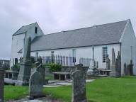
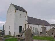
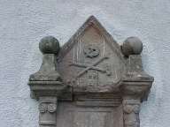
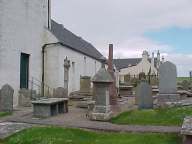
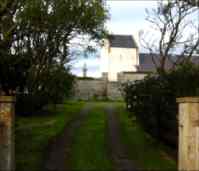
The church still retains the traditional layout with box pews and pulpit against the south wall.  The graves date from the 17th century.

Dunnet Bay Area Pages
For more information and wider area coverage.

Accommodation Can be found in
Tourist Pages of the
Caithness Business Pages

Information about the graves can be obtained from
North Highland Archive in Wick