| Harbours Index | |||
|
Brough Bay |
|||
|
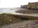
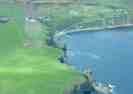
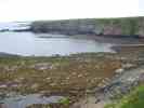
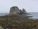
Brough Bay has a
small pier-slipway. A stack in the bay has collapsed some years ago.
The bay is still used by creel fishermen and some local people still have
boats here. There is a Brough Bay Pier Association. At
low tide there are many rock pools to explore. |
|||
|
|
|
|
|